Coalstoun Lakes
Mineral Resource
Resource Summary
– Coalstoun copper deposit total Inferred Mineral Resource of 26.9Mt @ 0.38% Cu (for 102,700t Cu contained); including a supergene copper Inferred Mineral Resource of 7.0Mt @ 0.47% Cu (for 32,700t Cu contained) in the partially oxidised zone (ASX 31 March 2015)
– Resource estimates have been completed within approximately eight months of the acquisition and transfer of the Coulston tenement (EPM 14079) from Newcrest and exclusively using historical information
– Drilling planned in May – June 2015 to target high-grade zones and extensions of supergene secondary copper with the intention of expanding and upgrading the initial Inferred Resources
Coalstoun Lakes Copper Deposit
Maiden Inferred Mineral Resource estimates (2012 JORC Code & Guidelines) have been completed at the Coalstoun copper deposit located within the Coalstoun Lakes Copper and Gold Project. Total Inferred Mineral Resource of 26.9Mt @ 0.38g/t Cu for 102,700t Cu contained; including a supergene copper Inferred Mineral Resource of 7.0Mt @ 0.47% Cu (for 32,700t Cu contained) at 0.3% Cu cut-off (Table 1, ASX 31 March 2015).
The deposit is located within the Coalstoun tenement (Figure 1) and is situated about 25km east of Gayndah in southeast Queensland.
EPM 14079 sits within the Esk Basin (formerly Esk Trough), a tectonostratigraphic member of the Devonian to Triassic New England Orogen.The Coalstoun Intrusive Complex occurs as a Middle Triassic Cu-Au-Mo mineralised porphyry system emplaced in meta-argillites of the Goodnight Block during regional shortening across the Northern New England Orogen in southeast Queensland (Figure 3). The Coalstoun copper deposit is associated with a topographic low surrounded by hills of the Walla Range, in the middle of the complex. Hydrothermal alteration and mineralisation
At least three intrusives are known from the drill hole information. Two are syn-mineral, porphyritic intrusions and one is a smaller post-mineral porphyritic intrusion. The syn-mineral intrusives vary in xenolith percentage to form ‘igneous breccia’ which are common throughout the area. Two hydrothermal breccia phases have also been identified grading from quartz-pyrite dominant to anhydrite, although the anhydrite phase appears to post-date mineralisation.
The Company commissioned independent consulting geologists H&S Consultants Pty Ltd (“H&SC”) of Brisbane, Australia to complete a resource estimate for the Coalstoun copper deposit.
The resource estimates are based on a total of 48 drill holes (9 reverse
Copper mineralisation consists of both
The oxide copper was modelled horizontally whereas the primary copper was modelled using an ellipsoidal set of parameters.
A total of 3,435 three metre composites were extracted from the drill hole database using the main mineralised intrusion wireframe; No top cutting was applied to the data.
Reporting of the resource estimate used a 0.3% copper cut off on un-cut data with a partial percent volume adjustment for the mineralised intrusion wireframe. Default density values were used as no density data could be obtained from historic reports.
All resources are classified as Inferred based on the wide and irregular drill hole spacing, limited QAQC data and lack of density data (Figures 4 and 5).
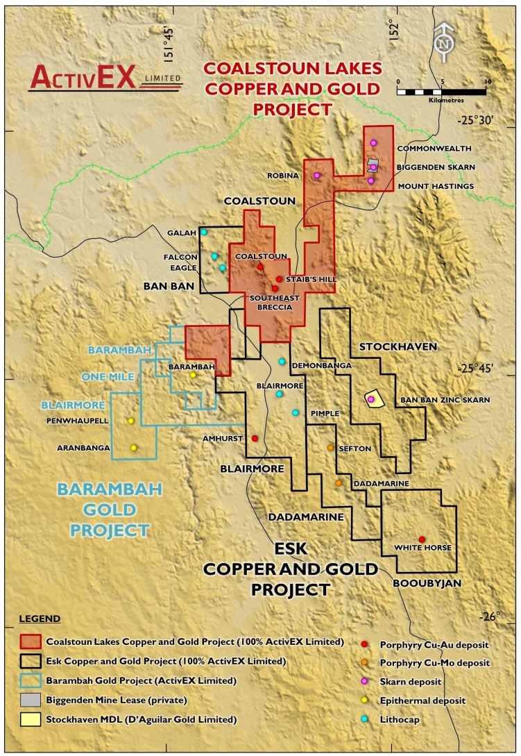
Figure 1:
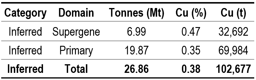
Table 1: Resource estimate figures for Coulstoun copper deposit (minor rounding errors)
Since acquiring the Coalstoun tenement,
The significant,
Historical assay interval from Esso22:
- 122.00m @ 0.48% Cu from 15.2m including 9.1m @ 2.3% Cu from 18.3m – no Au assayed
- 122.53m @ 0.44% Cu and 0.07g/t Au from 15.54m including 10.52m @ 2.07% Cu and 0.14g/t Au from 17.68m
The Coalstoun copper deposit has open pit heap leach potential and has synergies with
The Company is looking to bring both prospects to resource stage and giving consideration to a combined project development.
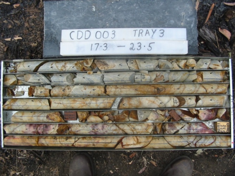
Figure 2: Supergene enriched copper zone in partially oxidised rock
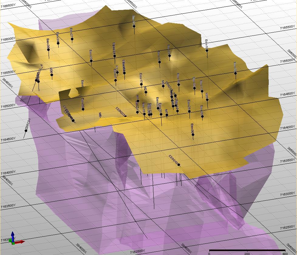
Figure 4: Isometric northeast view of drill holes and mineral zones (magenta = mineralised intrusion and country rock, yellow = supergene Cu and upper-oxidised [combined for clarity])
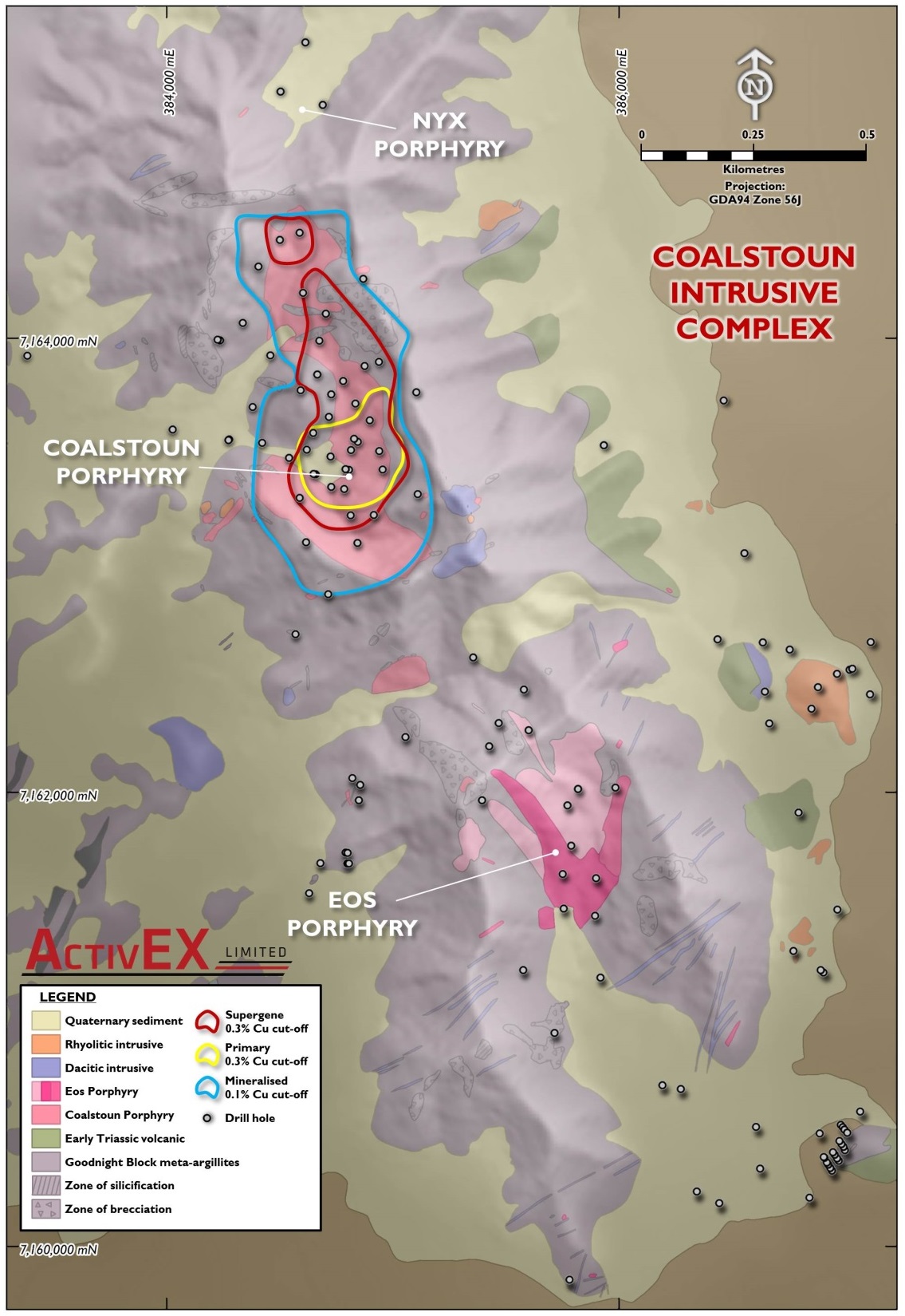
Figure 3: Coulstoun intrusive complex geology
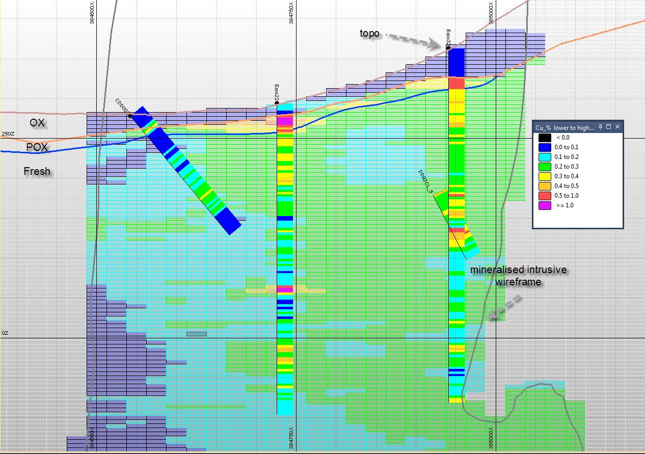
Figure 5: Copper lock grade distribution – cross section 7163475N